


Since everyone is back in school, we figured you were probably up to your neck in geography homework. We've put together a glossary of map terms, so now you have no excuse for getting lost in the hallway and finding yourself back under those warm blankets. Below are Map Terms - C to P!
Culture - We're not talking about traditions, beliefs and expression here. With maps it means man-made features on Earth that are symbolized on maps. Some examples are roads, buildings and electricity transmission lines.
Dead Reckoning - This is what a ship or airplane uses to pinpoint their location by using the last recorded location and how fast they are going. Dead reckoning is used when no other way of finding out your location is possible.
Degree - A unit used to measure latitude and longitude.
Elevation - How high a point or an object is above or below a datum (a reference point on the surface) - usually sea level. Elevation is also called altitude or height.
Equator - Also known as the equinoctial line. This is an imaginary circle around Earth, halfway from the poles and perpendicular to the Earth's axis of rotation. It divides the Earth in half into the Northern Hemisphere and the Southern Hemisphere.
 The equator divides the Northern Hemisphere and the Southern Hemisphere
Great Circle Route - The shortest distance between two points on an almost perfectly round surface (like Earth).
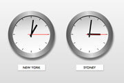
Greenwich Meridian - This is an imaginary line of longitude - it's also the 0 degree meridian. It is used as a reference to measure longitude east and west. It passes through Greenwich, England. It's also called the prime or international meridian.
Intersect - To cut across or overlap. Circles sometimes intersect each other on a map.
Latitude - The angular distance in degrees, minutes and seconds measured from the center of the Earth to a point north and south of the Equator. It's a system used to locate positions on Earth.
Legend - Your map is covered in symbols, lines and other strange figures. The legend is a short description of these symbols and figures so you can read what info is provided. It's usually in the margin.
Linear Feature - All those lines on your map are symbols and are important. Roads, rivers, railways and boundaries are examples of linear features.
Magnetic North - This is the direction a compass needle points. The Magnetic North Pole is slightly north of the Northwest Territories, Canada. Also see True North.
Nautical Mile - How distance is measured over water. It is the unit of length used to define the knot (speed of one nautical mile per hour) used by ships and airplanes. A nautical mile is 6,076.1 feet (1,852 meters). A statute or 'normal' mile is 5,280 feet (about 1.60935 kilometers).
 Nautical Mile
Navigation - How a vessel or airplane is able to get from one place to another. There are tons of different ways to do this including Global Positioning System (GPS), astronomical, Doppler, acoustic, ESP, etc. Okay, maybe not ESP.
North Pole - Located 90 degrees north in the Northern Hemisphere where the Earth's axis of rotation crosses the surface of the Earth. Also called the Arctic.
Parallels - Circles on a globe that are horizontal or parallel to the Equator. All the points have the same latitude. Parallels run in an east-west direction.
- To learn about Map Terms A - C click here.
- To learn about Map Terms P - Z click here.
Related Stories: