


Since everyone is back in school, we figured you were probably up to your neck in geography homework. We've put together a glossary of map terms, so now you have no excuse for getting lost in the hallway and finding yourself back under those warm blankets. Below are Map Terms - P to Z!
Point - A geographical feature (usually a single "x,y" pair) on the map that is too small to be considered an area.
Pole - One of two points on Earth where the Earth's axis crosses the Earth's surface. The North Pole and South Pole. Also one of two points on Earth that are equally distant from the equator.
Quadrant - A map of an area on Earth that is a quadrangle (any figure with four angles) that has the dimensions 15' longitude by 15' latitude. It's also one-fourth of a full circle.
 Clocks from around the world
Sea Level - The level of the ocean at any time.
Sextant - A hand-held instrument used to navigate when it's not convenient to use anything else. It measures angular distances between a celestial object and the horizon or between two stars. Basically, you use the stars to help you navigate with a sextant. The angle is a measured 60 degree angle arc, which is how it got its name.
Shoreline - A line on the map between an area of land and a body of water.
South Pole - Located 90 degrees south latitude in the Southern Hemisphere where the Earth's axis of rotation crosses the surface of the Earth. Also called Antarctica.
Surveying - Determining the boundaries, area, measurements of distance, direction, angle and elevations of land or structures on earth using geometry and trigonometry. There are several different types of surveys done to get data for a map including geodetic, phototraingulation, cadastral and field.
Time Zone - A region that has the same time everywhere within it. There are 24 standard time zones in the world, each with a space of one hour. Each zone is 15 degrees of longitude in length, centered on standard meridians 15 degrees apart and referenced to the Greenwich Meridian. Some of the North American ones are Pacific Time, Eastern Time, Mountain Time and Central Time.
 United States time zones
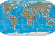
Tropic of Cancer - No, it's not another astrological sign. It's the latitude of 23 degrees 27' north. The Tropic of Cancer is the farthest North the sun can go. When it gets there, it's summer solstice for the Northern Hemisphere. This usually happens around June 21st and is the longest time of daylight in the Northern Hemisphere.
Tropic of Capricorn - The latitude is 23 degrees, 27' south. The Tropic of Capricorn is as far south as the sun can go. When it gets there, it's winter solstice. This usually takes place around December 21st and is the shortest period of daylight in the Northern Hemisphere.
True North - Direction of the northern rotational axis of the earth. The North Pole or "up" on a map.
- To learn about Map Terms A - C click here.
- To learn about Map Terms C - P click here.
Give us your opinion
Did we miss anything you weren't paying attention to in class and need to know for your next test? Comment below and let us know!
Related Stories: